


What's New
v0.2.3 [2014/04/06]
・中国/九州北部のレーダー画像がずれる不具合を修正(気象庁のWebサイトの仕様変更に対応)
v0.2.2 [2012/11/24]
・2012年11月19日に行われた気象庁のWebサイトの仕様変更に対応
・凡例の配色を気象庁のWebサイトに合わせて変更
v0.2.1 [2012/11/21]
・2012年11月19日に行われた気象庁のWebサイトの仕様変更に暫定的に対応
・設定画面に「レーダーの不透明度」を追加
・設定画面に「日時の背景の不透明度」を追加
v0.2.0 [2012/10/08]
・雷ナウキャストの表示範囲を拡大(北海道北部、沖縄南部を追加)
・竜巻ナウキャストの表示範囲を拡大(北海道北部、沖縄南部を追加)
・設定画面に「シークバーを表示する」を追加
・レーダー画面下部のシークバーに実測/予測の境界を追加
・レーダー画面上部の日時を左上から右上に移動
・レーダー画面上部の日時の色を微調整
v0.1.9 [2012/10/05]
・解析雨量・降水短時間予報の表示範囲を拡大(北海道北部、沖縄南部を追加)
About 雨雲マップ (beta) Android App
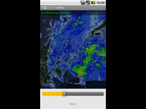
「雨雲マップ (beta)」は、全国の雨雲(降水)、雷、竜巻の状況を表示するアプリです。
Googleマップ上に各種レーダー画像を重ねて表示し、全国を横断的に表示できます。
■ 特徴
・全国に対応! 日本のほぼ全域をカバーしています。
・雨雲だけじゃない! 雷の活動度、竜巻の発生確度も表示できます。
・過去も未来も! 過去のレーダー画像、未来の予測画像を表示できます。
・ショートカットに対応! ホーム画面から「いつもの場所」を簡単に表示できます。
■ レーダーの種類
「雨雲マップ」で表示できるレーダーの種類は以下の通りです。
・降水ナウキャスト
5分毎に発表される雨雲(降水)の情報です。
1時間前~現在の5分毎の実測データ、現在~最大1時間後まで5分毎の予測データを表示できます。
「1mm/h未満」から「80mm/h以上」の8段階で降水の状況を示します。
・解析雨量・降水短時間予報
30分毎に発表される雨雲(降水)の情報です。
6時間前~現在の30分毎の実測データ、現在~最大6時間後までの1時間毎の予測データを表示できます。
「1mm/h未満」から「80mm/h以上」の8段階で降水の状況を示します。
・雷ナウキャスト
10分毎に発表される雷の活動度の情報です。
1時間前~現在の10分毎の実測データ、現在~最大1時間後までの10分毎の予測データを表示できます。
「活動度1」から「活動度4」の4段階で雷の活動度を示します。
・竜巻ナウキャスト
10分毎に発表される竜巻の発生確度の情報です。
1時間前~現在の10分毎の実測データ、現在~最大1時間後までの10分毎の予測データを表示できます。
「発生確度1」と「発生確度2」の2段階で竜巻の発生確度を示します。
なお、都道府県の境については、元データに該当箇所のデータが含まれていないため、消すことができません。ご了承ください。
■ アクセス許可(パーミッション)について
「雨雲マップ」が求めるアクセス許可の用途は以下の通りです。
・完全なインターネットアクセス
→レーダー画像、マップ画像、広告をインターネットから読み込むために使用します。
・ネットワーク状態の表示
→インターネットへの接続状態を確認するために使用します。
・ショートカットのインストール
→ホーム画面にショートカットを配置するために使用します。ユーザの操作なしにショートカットを配置することはありません。
■ 情報取得元について
「雨雲マップ」の表示内容は、気象庁より取得しています。
・レーダー・ナウキャスト(降水・雷・竜巻): http://www.jma.go.jp/jp/radnowc/
・解析雨量・降水短時間予報: http://www.jma.go.jp/jp/radame/
■ 動作確認端末
「雨雲マップ」は、開発時に以下の端末で動作を確認しています。
・Samsung Nexus S(Android 4.1.1)
・ASUS Nexus 7(Android 4.1.1)
・HTC Desire(Android 2.2.2)
■ その他
・本アプリは気象状況を予報するものではありません。自己責任のもと参考情報としてご利用ください。
・本アプリは開発の過程にあり、頻繁に更新される可能性があります。「自動更新」を有効にしておくことをオススメします。"Nimbus map (beta)", the nationwide nimbus (precipitation), thunder, is an application that displays the status of the tornado.
Is displayed over a variety of radar image on the Google map, you can cross-representation nationwide.
■ Features
Nationwide in the corresponding! Japan of I covers almost the entire area.
• The rain clouds do not just! Thunder of activity, and I can be displayed occurs accuracy of tornado.
· Past nor future! Past radar image, you can see the future prediction image of.
· Supports shortcut! You can easily display the "usual place" from the home screen.
■ radar kind of
Kind of radar that can be displayed in "clouds map" is as follows.
And precipitation nowcasting
This is the information of the nimbus (precipitation), which is published every five minutes.
1 hour ago - the actual measurement data of the current every five minutes, you can display the forecast data every 5 minutes until after the current to a maximum of one hour.
It indicates the status of the precipitation in 8 steps of "more than 80mm / h" from "less than 1mm / h".
And analyzing rainfall and precipitation short time forecast
This is the information of the nimbus (precipitation) to be announced every 30 minutes.
6 hours ago - the current every 30 minutes of actual measurement data, you can display the forecast data for each hour of until after the current to a maximum of 6 hours.
It indicates the status of the precipitation in 8 steps of "more than 80mm / h" from "less than 1mm / h".
Lightning nowcasting
This is the information of the activities of the thunder to be announced every 10 minutes.
1 hour ago - the current every 10 minutes of actual measurement data, you can display the forecast data every 10 minutes until after the current to a maximum of one hour.
It shows the activity of thunder in four stages of "activity 4" from "activity 1".
· Tornado nowcasting
It is a tornado information generation accuracy of which is announced every 10 minutes.
1 hour ago - the current every 10 minutes of actual measurement data, you can display the forecast data every 10 minutes until after the current to a maximum of one hour.
It indicates the generation accuracy of tornadoes in two stages of the "generation accuracy 1" and "occurrence accuracy 2".
It is to be noted that the boundary of the prefectures, because it does not include data of the corresponding point in the original data, it can not be erased. Please note.
■ permission for (permission)
"Rain cloud map" seek permission of the applications are as follows.
· Full Internet access
→ radar image, map image, the ad is used to read from the Internet.
Display of network status
→ It is used to confirm the connection to the Internet.
Installation of shortcuts
→ used to place a shortcut on the home screen. Never to place a shortcut on without user intervention.
■ For information acquisition source
Display the contents of the "rain cloud map", it can not get from the Japan Meteorological Agency.
Radar Now cast (precipitation, lightning, tornadoes): http://www.jma.go.jp/jp/radnowc/
And analyzing rainfall and precipitation short time forecast: http://www.jma.go.jp/jp/radame/
■ operation check terminal
"Rain cloud map" has confirmed the operation with the following terminal at the time of development.
· Samsung Nexus S (Android 4.1.1)
· ASUS Nexus 7 (Android 4.1.1)
· HTC Desire (Android 2.2.2)
■ Other
• This application is not intended to forecast the weather situation. Please use as the original reference information of self-responsibility.
- This app is in the process of development, there is a possibility that is frequently updated. We recommend that you enable the "automatic update".
Other Information:
Download
This version of 雨雲マップ (beta) Android App comes with one universal variant which will work on all the Android devices.
All Versions
If you are looking to download other versions of 雨雲マップ (beta) Android App, We have 1 version in our database. Please select one of them below to download.


